The Senus Soil agronomy technology is powered by a full campaign management system, allowing companies to seamlessly coordinate large-scale soil sampling programmes with ease. This tool also enables large-scale soil carbon programmes to be conducted with protocol adaptability and high levels of traceability.
Effortlessly manage extensive soil sampling campaigns, with real-time progress tracking and automated reporting. The app’s intuitive interface simplifies complex operations, reducing manual effort and minimising errors. The app is designed with flexibility in mind, adapting to various soil carbon protocols to ensure full compliance with local and international standards. This feature makes it an ideal tool for diverse environments. Every sample collected is meticulously tracked from collection to analysis, providing unparalleled transparency and accountability. This robust traceability ensures data integrity and fosters trust in your soil management practices.


Discover how companies around the globe have leveraged the power of Senus Soil to enhance their soil sampling and carbon monitoring efforts. From improving operational efficiency to achieving compliance with stringent carbon protocols, the app has proven to be an indispensable tool. The app integrates effortlessly with existing tools and platforms, ensuring seamless data exchange and comprehensive analysis. It’s compatible with various devices and operating systems, making it accessible anytime, anywhere.
Experience the future of soil management with Senus. Contact us for a demo, or connect with our team to learn how our technology can transform your soil sampling and carbon monitoring programs.
Collect data in-field via our app, which is adaptable to a wide range of sampling protocols that comply with national and international standards. The app’s intuitive interface simplifies complex operations, reducing manual effort and minimising errors.
Select your:
Track samples from field to lab to platform, with high levels of traceability throughout.
Barcoding technology speeds up sampling, eliminates labelling error in field and at the lab and it ensures end to end transparency of all data points.
")
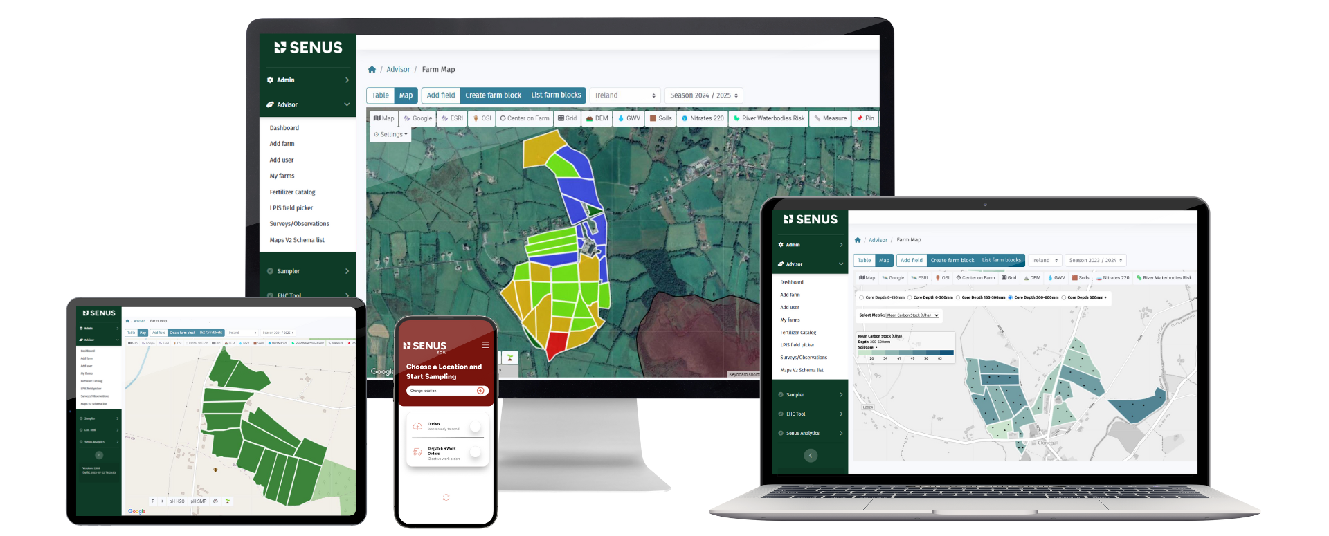
The Senus soil platform is a geospatial (mapping) system that enables the planning, collection and interpretation of soil sampling programmes. The platform is underpinned with a project management system making the management of sampling projects easy. Data management is unparalleled with robust tracking from collection to analysis, providing full transparency and accountability. This robust traceability ensures data integrity and fosters trust in your soil management practices.

Project management system giving full visualisation of sampling activity, logistics, admin and data flows.
Automated laboratory data feeds and Advanced analytics.
Farm maps with colour-coded data displays.
Automated farm level soil health or soil carbon report.
Traditional methods of soil sampling can be both costly and time-consuming. They also provide limited spatial coverage and represent a snapshot in time.
Using geospatial modelling, Senus can optimise where soil samples should be taken, reducing the number of in-field samples needed. This can reduce sample size by up to 50% vs random sampling, without a loss of precision.
If you have previously taken soil samples, these can be used to calibrate the model enabling further reductions in sample size.
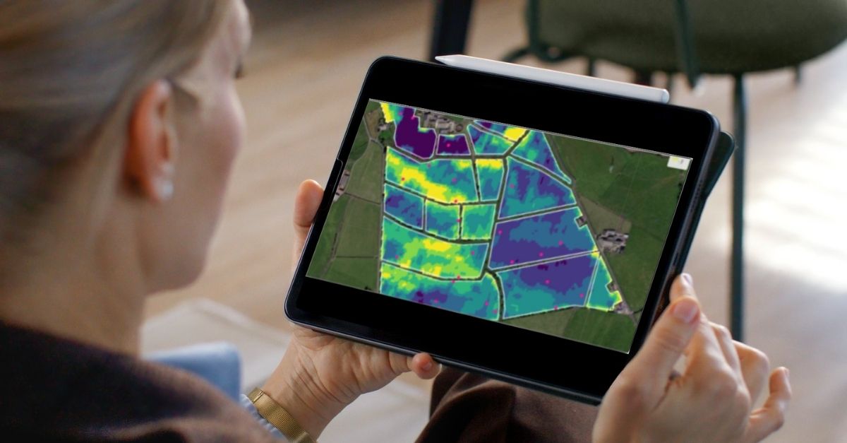
We use statistical modelling and machine learning to enable predictions across time and space, aiding the monitoring of soil changes. These models look for relationships between measured soil properties from soil samples and a set of geospatial predictors, such as slope, elevation, satellite-derived vegetation indices, climate data and more.
Our current soil models have been extensively trained for Europe, the USA, and South America.
Using these pre-trained models, we can predict:
The models have an uncertainty estimation, allowing us to generate a 95% prediction interval. This accounts for spatial auto correlation and enables us to produce an uncertainty estimation at regional (i.e. – farm) level, which is vital for carbon accounting.


Save time and increase control of sampling campaigns.
Increase accuracy of soil sampling.
Improve understanding with easy-to-interpret results.
Enhance data security and storage.
Full data transparency through the platform.
Meet governmental and corporate standards for data verification.
